By Danny Dotson, Head - Orton Memorial Library of Geology & Gardner Family Map Room; Mathematical Sciences Librarian & Science Education Specialist at The Ohio State University
Earlier this year, the University Libraries was presented with a need for maps of an Appalachian region. The goal was to find maps of parts of this region over a period of time to see how the topography changed due to mining. Information and visual representations derived from these maps were integrated into the exhibition Jonas N.T. Becker: A Hole is not a Void.
This project involved identifying maps that could meet the artist’s needs. This involved first identifying items in the catalog that could potentially fit and pull these maps. Since many of the maps were USGS maps, there were quite a number of maps pulled for further review.
The artist worked with staff and student workers at the Orton Memorial Library of Geology to give them specifics of their need, and some of our student workers examined the maps, looking for items matching those criteria. From these maps, the artist chose over 90 maps they wanted to digitize. The maps then went through our digitization request process.
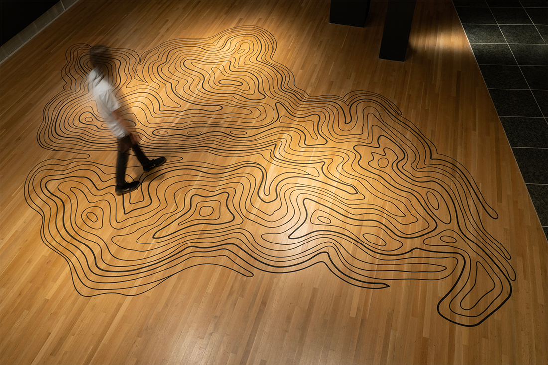
Two parts of the exhibition were based on the maps:
- Floor Topography: One of the maps was used to create a topographic map on the floor.

Gallery floor with a design based on topographic maps.
- 3D representations were created using some of these maps. A bit more about this is described in a video about the exhibit.


White raised relief maps located on gallery walls.
In addition to the map-based content, the exhibition included photographs, films, objects, and an event with a panel presentation. Jonas N.T. Becker: A Hole is not a Void was on display at Ohio State’s Wexner Center for the Arts from June 1 – August 21, 2024.
This exhibition is an example of how maps and other geospatial information can be used in unexpected ways. While the use of maps or geospatial information may be more traditionally thought of as associated with the sciences or social sciences, this work highlights how maps are being used in creative and impactful ways in the arts and humanities too.