By BTAA GIN Project Team Members
Feature: Ukraine Maps and Data
This post lists geospatial resources related to Ukraine from many sources around the world. While the Geoportal does contain some maps of Ukraine, they are from non-Ukrainian agencies and primarily date back to WWII (or older); these maps may not provide the information our users are currently seeking. Librarians from the Big Ten Academic Alliance Geospatial Information Network (BTAA GIN) Project Team have compiled some additional, more current resources for Geoportal visitors.
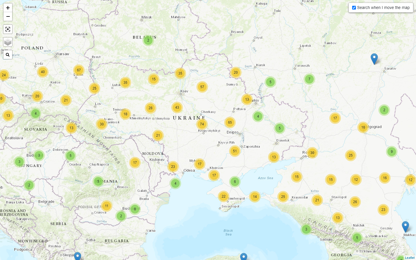
Caption: Map view of the Geoportal's resources on Ukraine. Click here or on the map to view search results in the Geoportal.
Maps and Data from News Agencies
These sources are provided by national-level news agencies. We believe that most of the content is freely available, though some portions may require a subscription.
Al Jazeera Infographic News: Russia-Ukraine war by the numbers: Live Tracker
Bloomberg: A Visual Guide to the Russian Invasion of Ukraine
The Guardian: Russia's war in Ukraine: complete guide in maps, video and pictures
NY Times: Ukraine Maps: Tracking Where Russian Forces Are Invading
Reuters: Russia invades Ukraine
LibGuides, Fact Sheets, and Other Resources from Member Libraries
Librarians at BTAA GIN member libraries have created these guides to highlight and supplement the Ukraine information available in their own collections. Some links within these guides are institution-specific and may require a login.
Background, News, and Additional Information
Country profiles
IMF: Ukraine and the IMF
Wikipedia: Ukraine
World Bank: The World Bank In Ukraine
News (note: these are Ohio State University Libraries links and may require an OSU login)
Where can I find out more?
Contact your library -- many libraries have subject specialists to help with questions on current and historical topics.