By Caroline Kayko
Featured Item or Collection: Afrique de la mappemonde Portugaise anonyme de 1502.
What is the item?
This item is a facsimile of a portolan map of Africa from 1502 with no known creator. The facsimile was produced in 1886 in the French publication Bulletin de geographie historique et descriptive, and is described in detail on pages 147-160 of volume 1. Note the rhumb lines in the image below, radiating out from the compass roses at the left and right borders of the map, likely indicating sailing routes. At the time of publication, the map had just been recently discovered in London. Despite the article being in French, the map is in Portuguese.
What BTAA Library submitted the item?
University of Michigan
Interesting tidbits
The author of the bulletin, Dr E.-T. Hamy, writes that it is rare and difficult in 1886 to find maps of early expeditions
He also describes the colors of the original map, which we cannot see on this facsimile
He received this map from a friend of his, who acquired it in London in a lot from an English traveler named King
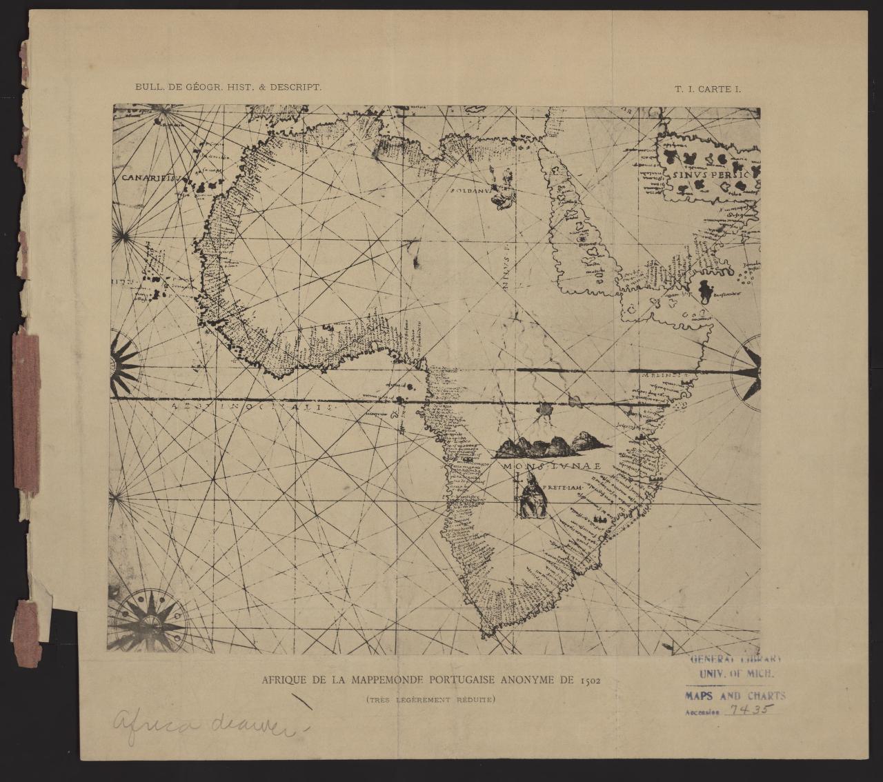
Caption: Portolan map of Africa, anonymous. Facsimile from 1886, original map from 1502.
Where can I find out more?
The full description is available in the original French through the Bulletin de geographie historique et descriptive, v.1, 1886, p. 147-160, in HathiTrust. Institutional login required.
Caroline Kayko is the Map & Geospatial Data Librarian at the University of Michigan.