By Kathleen Weessies.
This collection consists of 2,466 hand-drawn maps of Michigan’s townships.
Between 1816 and 1860, surveyors hired by the United States General Land Office walked and measured every township line and section (mile) line in the State of Michigan. Detailed notes were taken, and from those notes sketched maps were drawn of every survey township. The original plat maps were scanned by the Archives of Michigan and are now discoverable via their website https://Michiganology.org and geographically organized via the BTAA geoportal.
The original plat maps of the public land survey of Michigan are a valuable resource for original land survey information, as well as for understanding Michigan’s landscape. The plat maps and the corresponding surveyor’s notes contain detailed information about the original landcover and features of Michigan prior to dense settlement. The public may view each map in an interactive website or download each plat as a high resolution image.
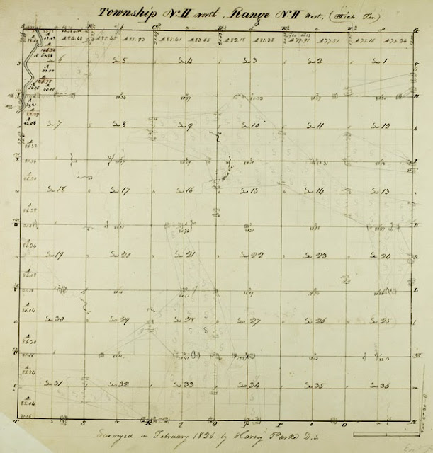 |
| Caption: The Grand River nips the northwest corner of Township 02 North, 02 West which is now organized as the political township Aurelius in Ingham County, Michigan. It was surveyed in 1826. The first land patent to a settler was issued 8 years later in 1834. |
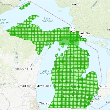 |
| A statewide index map provides a point-and-click interface to reach any map -- click on the map and below the index diagram a link will take you to that plat map. |