By Margaret Mering
Check out more items from the University of Nebraska's Image and Multimedia Collections in the BTAA Geoportal here.
Have questions about this item, the BTAA geoportal, or maps and geospatial data in general? Please don’t hesitate to contact our project team!
Margaret Mering is the Metadata Quality Librarian at the University of Nebraska-Lincoln
What are the items?
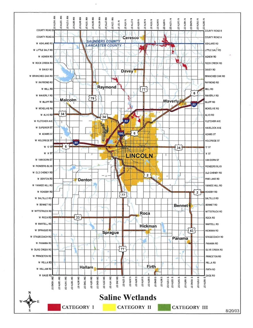
These maps show the Eastern Saline Wetlands areas of Lancaster and Saunders counties, Nebraska. The first map identifies the three categories of saline wetlands with Category 1 being of the highest quality. The aerial map identifies the names of the wetland areas.Caption: Saline Wetland Areas map produced by LPS Natural Resource District in 2003 showing locations around Lincoln, NE. (https://mediacommons.unl.edu/luna/servlet/detail/UNL~126~126~14388~1516077)
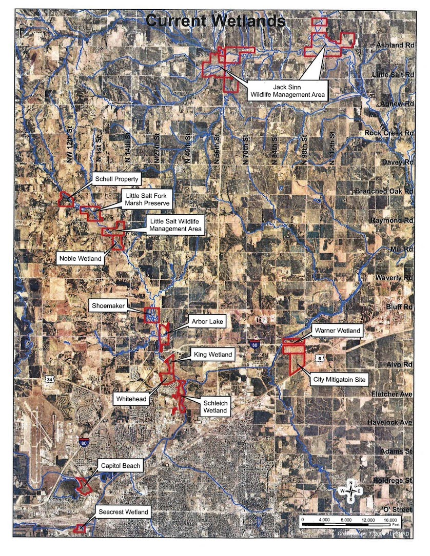
Caption: Saline Wetland Areas aerial image showing the names of the wetlands
What BTAA Library submitted the item?
University of Nebraska LincolnInteresting tidbits:
- The Eastern Saline Wetlands once covered an area of over 200,000 acres. Today, because of the drainages of Salt Creek, Little Salt Creek and Rock Creek and residential, commercial and agricultural development, the area is only around 4,000 acres (Lincoln Parks & Recreation, 2021).
- The Eastern Saline Wetlands is habitat for many endangered plants, birds, and other wildlife. Two endangered species are the Salt Creek Tiger Beetle and the Plains Harvest Mouse.
- Nebraska has four naturally occurring regional wetland complexes that combined cover around 1,500,000 acres.
- https://mediacommons.unl.edu/luna/servlet/UNL~126~126 is a link to a University of Nebraska-Lincoln collection of more maps and other images of the Eastern Saline Wetlands. This collection was created and contributed by Tom Malmstrom, the Natural Resources Coordinator for Lincoln Parks & Recreation, and the Lower Platte South Natural Resource District
Check out more items from the University of Nebraska's Image and Multimedia Collections in the BTAA Geoportal here.
Have questions about this item, the BTAA geoportal, or maps and geospatial data in general? Please don’t hesitate to contact our project team!
Margaret Mering is the Metadata Quality Librarian at the University of Nebraska-Lincoln