By Kathleen Weessies
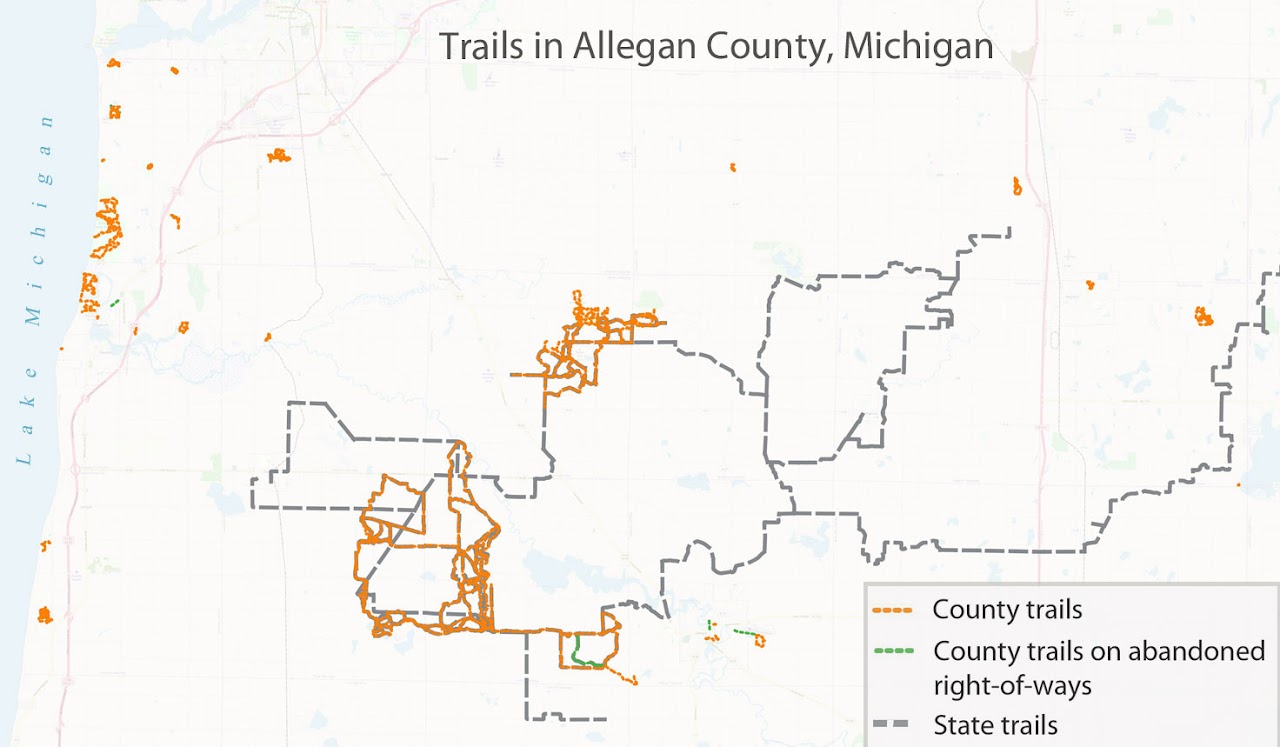
The BTAA Geoportal brings together datasets from different sources. This can be helpful when you’re looking for data gathered by multiple government units. Trails are a perfect example: The state government and a local government will be paying attention to the trails under its own care. The joggler or unicyclist, however, only wants maintained surfaces away from motor vehicles.
This map shows the trail dataset available from the State of Michigan (gray dashed line) and the trail dataset from Allegan County (orange dashed line). We can readily see that each entity has features that the other doesn’t.
The attribute information can also vary, depending on what the unit of government prioritized in the data gathering process. In this case, Allegan County tagged each trail by its corridor type. This allows us to separate out and highlight trails that were built on abandoned railroads (green dashed lines). The State of Michigan dataset doesn’t provide this detail.
This example also illustrates how data generated at the local level is often more detailed than larger more generalized datasets. The BTAA geoportal brings together datasets creating a convenient point of discovery for researchers seeking GIS Datasets.
Have questions about this item, the BTAA geoportal, or maps and geospatial data in general? Please don’t hesitate to contact our project team!
Kathleen Weessies is the Head of the Map Library at Michigan State University.
The BTAA Geoportal brings together datasets from different sources. This can be helpful when you’re looking for data gathered by multiple government units. Trails are a perfect example: The state government and a local government will be paying attention to the trails under its own care. The joggler or unicyclist, however, only wants maintained surfaces away from motor vehicles.
This map shows the trail dataset available from the State of Michigan (gray dashed line) and the trail dataset from Allegan County (orange dashed line). We can readily see that each entity has features that the other doesn’t.
The attribute information can also vary, depending on what the unit of government prioritized in the data gathering process. In this case, Allegan County tagged each trail by its corridor type. This allows us to separate out and highlight trails that were built on abandoned railroads (green dashed lines). The State of Michigan dataset doesn’t provide this detail.
This example also illustrates how data generated at the local level is often more detailed than larger more generalized datasets. The BTAA geoportal brings together datasets creating a convenient point of discovery for researchers seeking GIS Datasets.
What BTAA Library submitted the item?
Michigan State UniversityWhere can I find out more?
Michigan Trail Map, from Michigan Trails & Greenways AllianceHave questions about this item, the BTAA geoportal, or maps and geospatial data in general? Please don’t hesitate to contact our project team!
Kathleen Weessies is the Head of the Map Library at Michigan State University.