By Caroline Kayko


Check out more resources from the BTAA Geoportal from Washtenaw County!
Have questions about this item, the BTAA geoportal, or maps and geospatial data in general? Please don’t hesitate to contact our project team!
Caroline Kayko is the Map & Geospatial Data Librarian at the University of Michigan.
What is the item?
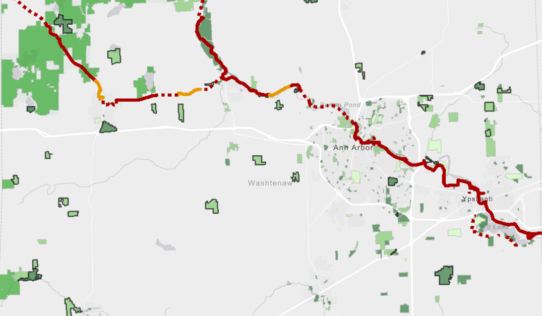
This item is a geospatial dataset depicting the Border-To-Border (B2B) Trail in Washtenaw County, MI in both shapefile and geodatabase file form. The B2B Trail is a non-motorized trail that stretches across Washtenaw County and connects cities, parks, and other destinations. It is currently still under construction, which is reflected in the dataset.
What BTAA Library submitted the item?
University of MichiganInteresting tidbits:
- The trail length will total 70 miles upon completion
- It spans 35 miles along the Huron River Greenway, connecting Ann Arbor, Dexter, and Ypsilanti
- Conservation of the Huron River corridor is one of the project goals
- The trail is intentionally routed away from roads to create an ‘urban wilderness

Where can I find out more?
Check out more resources from the BTAA Geoportal from Washtenaw County!
Have questions about this item, the BTAA geoportal, or maps and geospatial data in general? Please don’t hesitate to contact our project team!
Caroline Kayko is the Map & Geospatial Data Librarian at the University of Michigan.