By Cecilia Smith
This interview is part of our Data Provider Series, which highlights local governments and institutions that offer open GIS data. In each interview, providers tell us about their missions and data resources. We hope this will be a great way for readers to learn more about local GIS developments and new initiatives.
This interview is part of our Data Provider Series, which highlights local governments and institutions that offer open GIS data. In each interview, providers tell us about their missions and data resources. We hope this will be a great way for readers to learn more about local GIS developments and new initiatives.
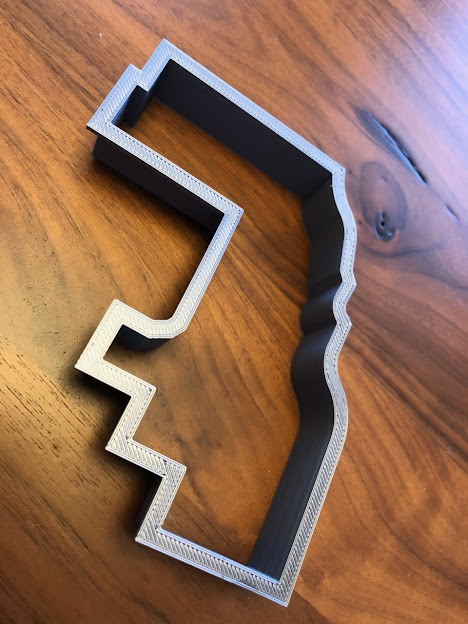
“Cookie County” a cookie cutter made by the
Cook County GIS Department staff for GIS Day 2019.
Interviewee Name:
Todd Schuble
Title:
GIS Manager
Division/Department:
Cook County Bureau of Technology, GIS Department
Website:
https://www.cookcountyil.gov/agency/geographic-information-systems-gis-0

Due to the spread of Covid19, BOT/GIS has been working remotely since March 17, 2020 without a large disturbance to our workflow. Since our staff is technically inclined anyhow, the switch to remote work to accomplish tasks was not really that painful. The one major thing we are unable to do while working from home is being able to print paper maps. Our laptops are portable, large format plotters, not so much.
Check out more data from Cook Central in the BTAA Geoportal here.
Have questions about the BTAA geoportal, or maps and geospatial data in general? Please don’t hesitate to contact our project team!
Interviewee Name:
Todd Schuble
Title:
GIS Manager
Division/Department:
Cook County Bureau of Technology, GIS Department
Website:
https://www.cookcountyil.gov/agency/geographic-information-systems-gis-0
Can you describe how GIS is deployed organizationally by Cook County Government? Which units are involved and what is your mission?
The Cook County Bureau of Technology’s GIS Department (BOT/GIS) falls under the jurisdiction of the Cook County President’s Office. All other bureaus and departments that report to the Cook County President’s Office utilize BOT/GIS for spatial data distribution and curation, GIS software license access, and GIS application development. The GIS Department has close relationships with offices of other elected officials in Cook County (Clerk, Assessor, Sheriff, etc.). Those elected offices also use BOT/GIS for many of the same services as those mentioned. The mission of BOT/GIS is to create and provide validated spatial data and/or GIS applications to various departments throughout Cook County and the general public.What geospatial layers and apps do you create? Which are your most popular GIS products?
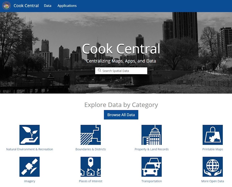
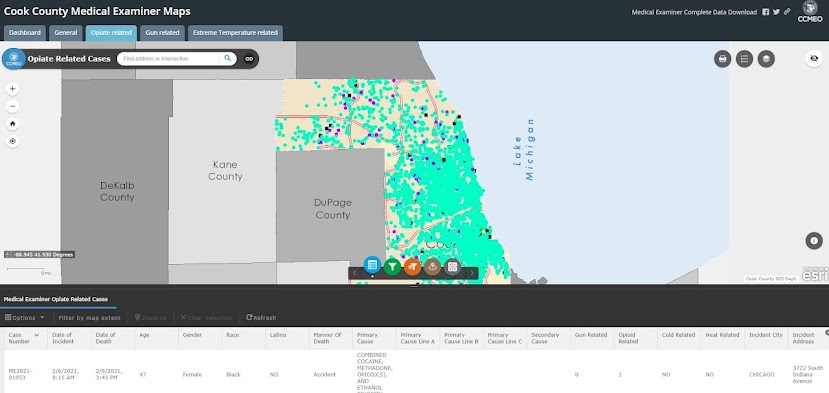
The number of GIS data layers and applications curated or maintained by BOT/GIS literally runs into the thousands. A majority of these items are available through Cook Central (https://hub-cookcountyil.opendata.arcgis.com/), which is the GIS open data portal for Cook County. Some of the most popular products that BOT/GIS maintains are the Cook County parcel layer, various political boundaries, or more focused applications like the Medical Examiner’s Case Archive (https://maps.cookcountyil.gov/medexammaps/)Chicago makes up a sizable portion of Cook County. How does the size and complexity of the city impact county GIS work? How do you work with the city?
The City of Chicago maintains separate GIS data layers and applications meant for its own use. The GIS work that Chicago and Cook County do often complements each other. The goal is to not duplicate services but instead to enhance them. The two local governments have a good working relationship and we do communicate when projects may happen to overlap.The Racial Tapestry of Cook County.
Map created by Todd J. Schuble, Cook County BOT/GIS using ESRI ArcGIS 10.4.1. U.S. Decennial Census data collected from SocialExplorer.com by U.S. Census Block Group. Municipal and community area boundaries available for download from Cook Central.
How do you work with other local and state institutions? What other kinds of collaborative efforts does Cook County Government GIS participate in?
BOT/GIS maintains strong lines of communication with the municipalities within Cook County and with the GIS departments of counties in northeastern Illinois. This communication is crucial for exchanging ideas or collaborating on validating or collecting data. Cook County’s GIS Department is also an active participant in the Illinois GIS Association which represents GIS interests of numerous local government entities throughout Illinois.Can you describe some ongoing or new projects? How have current events prompted new initiatives or workflows?
BOT/GIS is always looking for new and innovative projects to dive into. BOT/GIS recently signed a contract to collect hyperspectral data for the entire county on a bi-annual basis. That new data will allow us to see various changes in the built and natural environment that would otherwise be difficult to monitor at scale. BOT/GIS is also working on constructing a 3D building layer for the entire county using previously collected LiDAR data. Even simple things, like embedding tax code boundary information directly into our parcel layer, was just produced and eases the burden on many of our municipalities from taking extra steps to hunt down that information.Due to the spread of Covid19, BOT/GIS has been working remotely since March 17, 2020 without a large disturbance to our workflow. Since our staff is technically inclined anyhow, the switch to remote work to accomplish tasks was not really that painful. The one major thing we are unable to do while working from home is being able to print paper maps. Our laptops are portable, large format plotters, not so much.
Cook County Medical Examiner Maps created by Todd Schuble
Check out more data from Cook Central in the BTAA Geoportal here.
Have questions about the BTAA geoportal, or maps and geospatial data in general? Please don’t hesitate to contact our project team!