By Cecilia Smith
The Cook County imagery dating from 1998 is discoverable in the geoportal. Cook County Government makes the data available through the Cook Central Open Data Portal as a web service and as a downloadable data set.
Cecilia Smith is the GIS & Maps Librarian at the University of Chicago.
Featured Item: Aerial Imagery: Cook County, Illinois, 2003
What is the item?
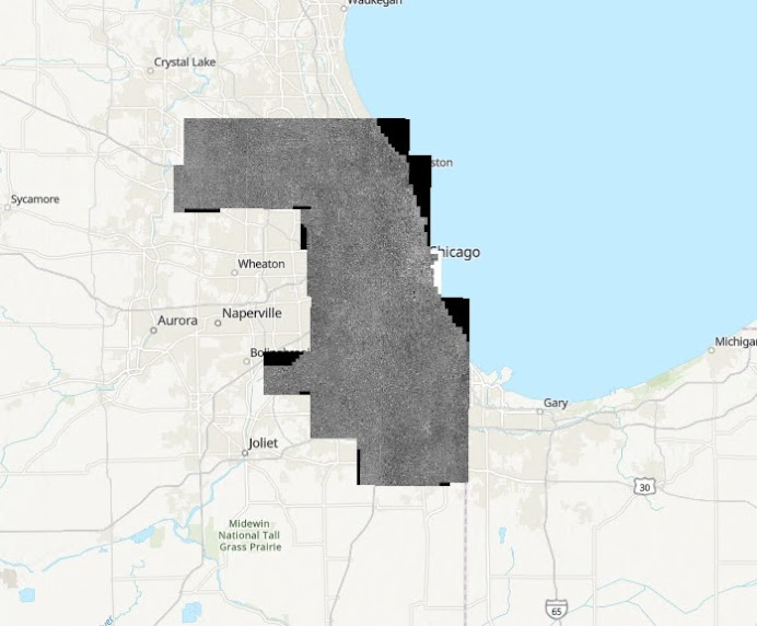
This is black and white aerial imagery captured in 2003 for Cook County, Illinois at 6 inch pixel resolution. The imagery was taken with panchromatic film, which is film sensitive to all wavelengths of visible light and capable of high spatial resolution.The Cook County imagery dating from 1998 is discoverable in the geoportal. Cook County Government makes the data available through the Cook Central Open Data Portal as a web service and as a downloadable data set.
What BTAA Library submitted the item?
University of ChicagoFull extent of the 2003 Cook County imagery
Interesting tidbits:
- The 2000s in Chicago saw investments in green and public spaces and changes to zoning and land uses that are apparent when comparing the 2003 imagery to later years.
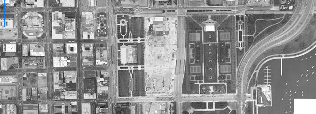
- A series of public spaces opened in Chicago beginning in 2004. The 2003 imagery shows the construction of Millennium Park, a highly celebrated and controversial public space. It is also home to Cloud Gate, commonly referred to as the “Bean.”
- In 2004 Chicago approved a new zoning ordinance in response to a boom in residential construction that was, at least in part, to protect the aesthetics of Chicago neighborhoods. However, there is also a correlation between the increase in discrete zoning districts since the ordinance passed. A comparison of the 2003 aerial imagery to later years will show the impact of the zoning measures.
Check out these before and after images:
2003
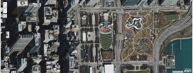
2021
Millennium Park in 2021
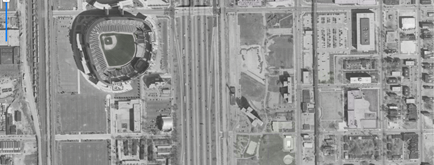
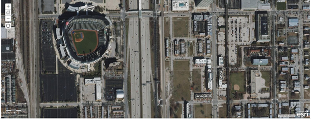
2003
Home of the White Sox, Comiskey Park was renamed U.S. Cellular Field in 2003. Open green space is visible across I-90 to the west.
2021
Renamed Guaranteed Rate Field in 2016, the field now overlooks new mixed use developments.
Where can I find out more?
- Cook County Government provides more detailed information about the 2003 imagery.
- The Chicago Metropolitan Agency for Planning (CMAP) provides historical and current land use data.
Cecilia Smith is the GIS & Maps Librarian at the University of Chicago.