By Jae Sung Kim
This interview is part of our Data Provider Series, which highlights local governments and institutions that offer open GIS data. In each interview, providers tell us about their missions and data resources. We hope this will be a great way for readers to learn more about local GIS developments and new initiatives.

Name: Maurie Kelly
Title: Director
Division/Department: Pennsylvania Spatial Data Access (PASDA)
Website: www.pasda.psu.edu
“The data made available through PASDA is provided by our data partners to encourage the widespread sharing of geospatial data, eliminate the creation of redundant data sets, and to further build an inventory (through the development and hosting of metadata) of available data relevant to the Commonwealth. PASDA serves as a resource for locating data throughout the Commonwealth through its data storage, interactive mapping applications, and metadata/documentation efforts.
PASDA is a cooperative project of the Governor's Office of Administration, Office for Information Technology, and Penn State Institutes of Energy and the Environment of the Pennsylvania State University. Funding and support is provided by the Pennsylvania Office for Information Technology. Penn State contributions include system administration support and infrastructure from the Institute for Computational and Data Sciences, and the College of Earth and Mineral Sciences.
PASDA was developed as a service to the citizens of the Commonwealth of Pennsylvania. The purpose of PASDA is to serve as the Commonwealth's comprehensive and coordinated open geospatial data portal that provides free public access to geospatial data and information by, for, and about the Commonwealth of Pennsylvania. PASDA is Pennsylvania's node on data.gov and is integrated with the National States Geographic Information Council GIS Inventory.
One of the primary purposes of PASDA is to facilitate data sharing in a streamlined environment, making the process fast and easy for data sharing stakeholders. Any state agency, local government, non governmental agency, or academic institution can share its geospatial data through PASDA at no charge.
PASDA is based on a long term vision that incorporates free access to data, outreach, and service to our users and data providers in order to maximize the benefits to the citizens of the Commonwealth.
The keystones in the success of the program are:
This interview is part of our Data Provider Series, which highlights local governments and institutions that offer open GIS data. In each interview, providers tell us about their missions and data resources. We hope this will be a great way for readers to learn more about local GIS developments and new initiatives.
Name: Maurie Kelly
Title: Director
Division/Department: Pennsylvania Spatial Data Access (PASDA)
Website: www.pasda.psu.edu
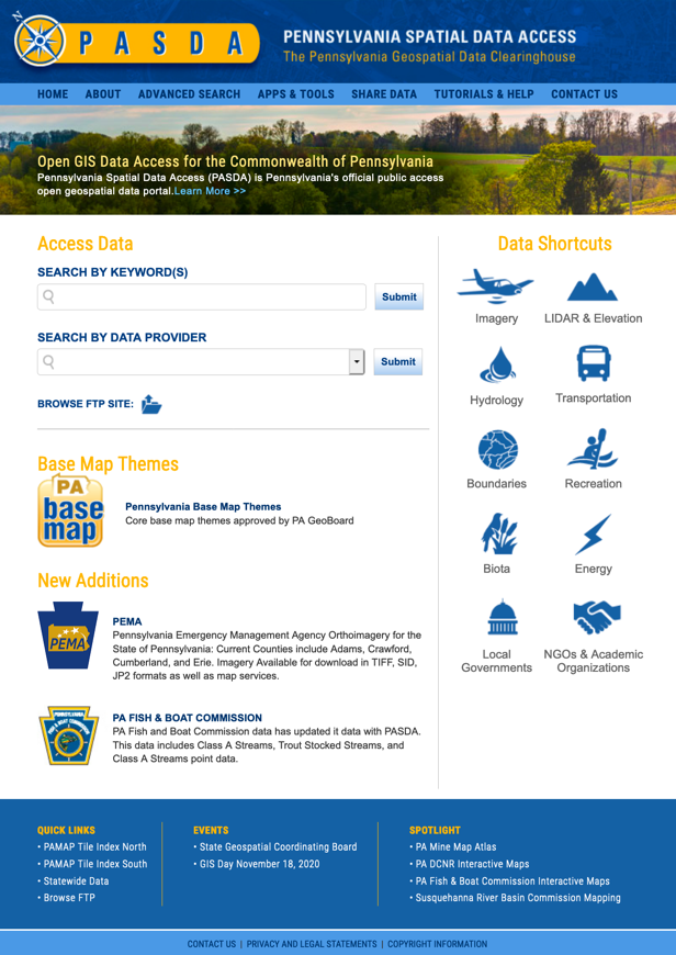
About Pennsylvania Spatial Data Access (PASDA)
Using PASDA, users can easily find geospatial data with various functions including preview and download. Maurie Kelly noted that:“The data made available through PASDA is provided by our data partners to encourage the widespread sharing of geospatial data, eliminate the creation of redundant data sets, and to further build an inventory (through the development and hosting of metadata) of available data relevant to the Commonwealth. PASDA serves as a resource for locating data throughout the Commonwealth through its data storage, interactive mapping applications, and metadata/documentation efforts.
- PASDA will continue to provide free access to and storage of geospatial data that can be shared by anyone with an Internet connection.
- PASDA will continue to build partnerships that enhance ease of access to data by community and to benefit the data provider.
- PASDA will continue to develop data access resources and innovative tools to enhance the use and benefits of geospatial data for all citizens of the Commonwealth and geospatial community.
- PASDA will continue to support long term archiving and preservation of data for the benefit of the Commonwealth and future generations”.
Interview
1. What geospatial data layers do you create?
PASDA does not create GIS data. We are a data portal and provide access to data from other providers.2. What types of geospatial data are commonly requested?
PASDA currently provides access to hundreds of thousands of datasets from providers throughout Pennsylvania, the US Federal government, and other entities that create data about Pennsylvania. The most commonly used data sets are various years of imagery, roads, parcels, and oil and gas wells.3. How is your geospatial data distributed?
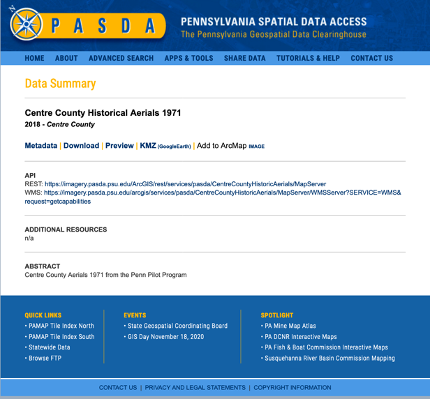
Users can download it for free (via FTP) or can consume map services or view the data in one of our applications.4. What is your most popular dataset?
It depends on what is going on. Generally the most recent imagery is extremely popular.Landing page for Centre County Historical Aerials 1971. Using PASDA, users can easily find geospatial data with various functions including preview and download.
5. What is the mission of your agency?
Pennsylvania Spatial Data Access (PASDA) is Pennsylvania's official public access open geospatial data portal. PASDA was developed in 1995 by the Pennsylvania State University and has served as the geospatial data portal for Pennsylvania for over twenty five years.PASDA is a cooperative project of the Governor's Office of Administration, Office for Information Technology, and Penn State Institutes of Energy and the Environment of the Pennsylvania State University. Funding and support is provided by the Pennsylvania Office for Information Technology. Penn State contributions include system administration support and infrastructure from the Institute for Computational and Data Sciences, and the College of Earth and Mineral Sciences.
PASDA was developed as a service to the citizens of the Commonwealth of Pennsylvania. The purpose of PASDA is to serve as the Commonwealth's comprehensive and coordinated open geospatial data portal that provides free public access to geospatial data and information by, for, and about the Commonwealth of Pennsylvania. PASDA is Pennsylvania's node on data.gov and is integrated with the National States Geographic Information Council GIS Inventory.
One of the primary purposes of PASDA is to facilitate data sharing in a streamlined environment, making the process fast and easy for data sharing stakeholders. Any state agency, local government, non governmental agency, or academic institution can share its geospatial data through PASDA at no charge.
PASDA is based on a long term vision that incorporates free access to data, outreach, and service to our users and data providers in order to maximize the benefits to the citizens of the Commonwealth.
The keystones in the success of the program are:
- Collaboration--PASDA demonstrates that collaboration among the geospatial community benefits everyone in the Commonwealth. Collaboration saves money, time, and makes the most of the limited resources of data providers and the Commonwealth.
- Cooperation--PASDA cooperates with all levels of government, non-profits, academia, business, and citizens to support the geospatial data infrastructure and access to data.
- Continuity--PASDA works with data providers to ensure continuity of data access and long term storage and archiving of data.
- Active engagement--PASDA engages with the geospatial community to foster understanding and data sharing.
- Efficiency--PASDA's streamlined processes make data sharing fast and easy for our partners and data access simple for our users.
- Free Access--PASDA provides open access to data in multiple formats and via applications free of charge to the public.