By Caroline Kayko
Visit our Featured Collection: Nichols Arboretum and Matthaei Botanical Gardens
The Matthaei Botanical Gardens and Nichols Arboretum (MBGNA) is a University of Michigan organization that promotes environmental conservation and enjoyment of nature in two locations in Ann Arbor, MI: the Nichols Arboretum, and Matthaei Botanical Gardens. The MBGNA has an open data GIS hub where they host datasets about vegetation, trails, land cover, geology, and more. These can be used by anyone from botanists to nature trail enthusiasts.Aerial Imagery
- There are scanned aerial images from sporadic years, the oldest being from 1937 and the newest being from 2006.
- There is also digital orthoimagery of the botanical garden from 2010 from a SEMCOG orthoimagery project.
 |
| Close-up of aerial imagery showing handwritten notes denoting farms on the botanical gardens grounds, 1949. |
Interactive Maps
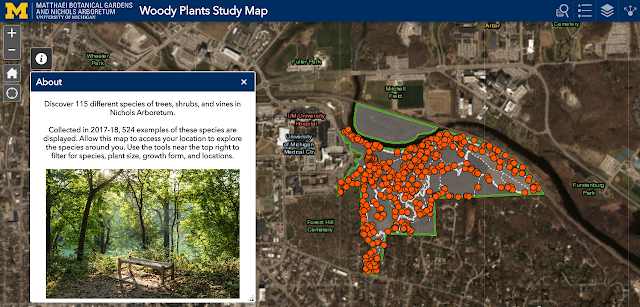
Some notable interactive maps on the open data hub include the Matthaei-Nichols Botanical Surveys. This conservation data project analyzed the 16 distinct plant communities on the properties - several of which are at-risk worldwide - for management and conservation purposes. |
| Interactive map of woody plants in the Nichols Arboretum. |
Related Historical Maps
The University of Michigan also holds in our collection several maps of the Nichols Arboretum from 1906, noting different types of vegetation in the area.
