By Cecilia Smith
Thanks to these types of data, Iowans can track the movement of their snow plows live:
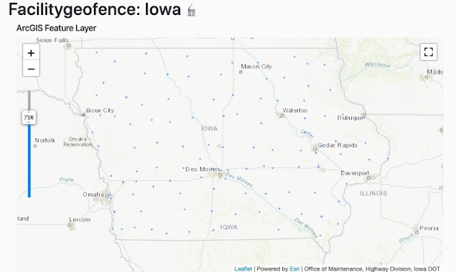
Facility Geofence: Iowa
What is the item?
A shapefile with the Salt and Brine locations for Iowa Department of Transportation facilities.What BTAA Library submitted the item?
University of Iowa
Interesting tidbits:
- Salt and Brine locations are where Iowa DOT’s snow plows are kept.
- This data layer contains a polygon for each of these locations. Each polygon covers the entire area on which a facility sits. This enables two related geospatial applications: geofencing and automated vehicle location (AVL).
- Geofencing is the use of a virtual perimeter for a real geographic area.
- AVL involves determining the geographic location of a vehicle and transmitting the information to a database.
- In this case, the polygons act as geofences, meaning that as an AVL enabled snow plow enters or leaves the area of a polygon, the trip start or stop is recorded. That information can then be used for planning operations and communication to the public.
Thanks to these types of data, Iowans can track the movement of their snow plows live:
 |
| Plow Locations and Images on Iowa's 511 application |
 |
| Images from an Iowa snow plow, updated every 5 minutes |
 |
| Track a plow layer from the Iowa DOT on ArcGIS Online |
